this map is not very accurate
Lake Huron
Woke up before sunrise, i wanted to be on the road as soon as possible i had a side trip planned for today.
Took the trail back to the road, stop by the campsite to clean up a little.
Got back on Rte 23 and continued to town called Mackinaw. From Mackinaw i took a ferry to Mackinaw Island, i heard so many things about it i had to go and yes it was well worth it.
Back from campsite to Rte 23
Waiting for the ferry to arrive
There she comes
Small Island next to Mackinaw Island
The ferry trip took 18 min, as you can see those jet boats could move fast, not sure of the distance.
When i exit the ferry and came out of the tunnel on to the streets of the island it felt like a wonderland for people that like bicycles and fudge, those are the 2 major attractions and there is some history here too.
Down Town
There is a 8 mile loop around the island with beautiful views of the lake, and many other routes that take you all over the island.
At the bottom there is the loop around the lake
When i got back from the island i road my bike maybe 2 miles by the bridge, from there i called the bridge authorities to come a pick me up, bicycles are not allowed there, high wind, no bike lane, it was 5$ for them to take me over.
Into the wild, Upper Peninsula MI
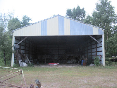
From there i kept going north toward lake Superior, some time around 8 i got to this campsite in a Indian Reservation, it was for sale and looked abandoned, i looked around and decided to set up in the big where house. Boy- was i happy to be in that building, it rained like hell for most of the night.
N 45 40.2001 W084 25.2003


Beautiful shot of the Lake Huron.
ReplyDeleteFor the moment I thought that you are already in China! (all that bicycles)